Objective
The objective of the project is to define different
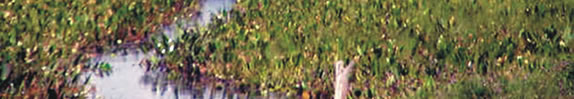
regions in the wetlands of Ypoa, Republic of Paraguay, through
information obtained from the processing and analysis of satelital
images.
Materials and Methods
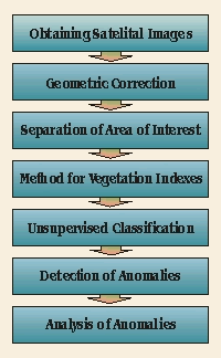
The methodology used can be grouped into various processes. The first
of them is Obtaining the Satelital Images corresponding to the region
of Ypoa. For this purpose we count on an agreement with CONAE (Argentina).
The images correspond to the satelites SAC-C, Landsat-7, and Landsat-5
of the AM Constellation; specifically the zone defined by the sector ‘PATH
226 ROW 78’ and they are received in a processing level of 4X
in Full Fast Format NN TM-WGS84.
After that, a geometric correction and a georreferentiation
of the images is done. That is, an image is assigned coordinates
according to a standard geographic reference system, in our
case, UTM 21st zone system. Once the referentiation is done,
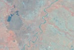
we proceed to cut the image according to an area of interest
defined by topographic and hydrologic criteria. The area of
interest corresponding to this project has as limits the Paraguay
River to the West, the Tebicuary River to the South and the
100 m contour line to the Northeast.
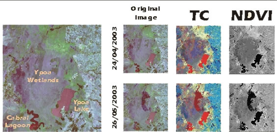
Once we have obtained the specific area of
study, we apply different indexes, such as general propose
ones, like Tasseled Cap Transform and NDVI vegetation indexes.
Then, we proceed to classify the landscape into sectors according
to the obtained data.
This process is performed on images obtained
in different dates, over the interval between the years 2001
and 2003. After these steps are concluded we have enough information
to proceed to Detect and Analyse Anomalies.
The whole process is followed using specific software for this kind of
tasks, namely
- Erdas Imagine versión 8.5
- ArcView GIS 3.2a